The site and it's context
Site context
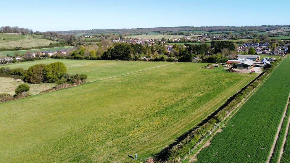
The site (edged red on the aerial photograph below) is located in the central part of Clanfield, a village in East Hampshire. The village lies approximately 8 miles north of Portsmouth and 2 miles south of Petersfield, to the west of the A3(M). The site lies to the south of Drift Road with housing on three sides and agricultural land to the east.

The site
The location and extent of the site is shown on the aerial photograph above. The site measures 6.6 hectares / 16.3 acres and comprises three open areas of grazing land, a group of modern agricultural buildings, and the property, Charity Farm.
The site currently benefits from vehicular access via Drift Road with a track running along the western boundary of the site. There are no public rights of way within the site or in the near vicinity.
The site lies central to the wider Clanfield Village area, with residential development to the west in Downhouse Road backing onto the site, housing to the north of Drift Road, and a large arable field to the east with further development including the village centre beyond.
The eastern boundary of the site is well defined with a mature hedgerow and some trees. The boundaries of the southern parts of the site are defined by rear gardens and a small field to the southwest, north of No.64 Downhouse Road.
There is limited mature vegetation within the site itself and the boundaries of the site are defined by a mix of hedgerows, with some trees, and timber fences. There are no known Tree Preservation Orders (TPOs) within the site.
See the photos below for a visual understanding of the site under discussion; the images show photographs taken of the site both on foot and via drone.


